Track your routes!
Start using our RIDE Computer today for only 1.99 €.
RIDE Computer turns your iPhone into a clear, reliable ride dashboard. Built for cyclists and bikers, it shows your speed, distance, time and altitude at a glance.

A faster recording
Is it annoying when you go for a ride and forget to turn on route tracking? The RIDE Computer has automatic tracking. When you start the app, tracking begins immediately as you start moving.
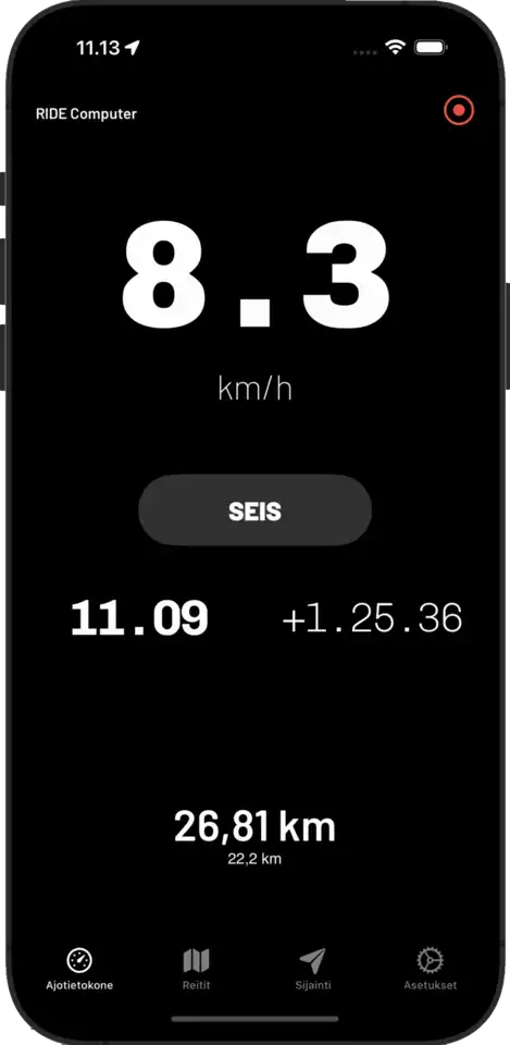
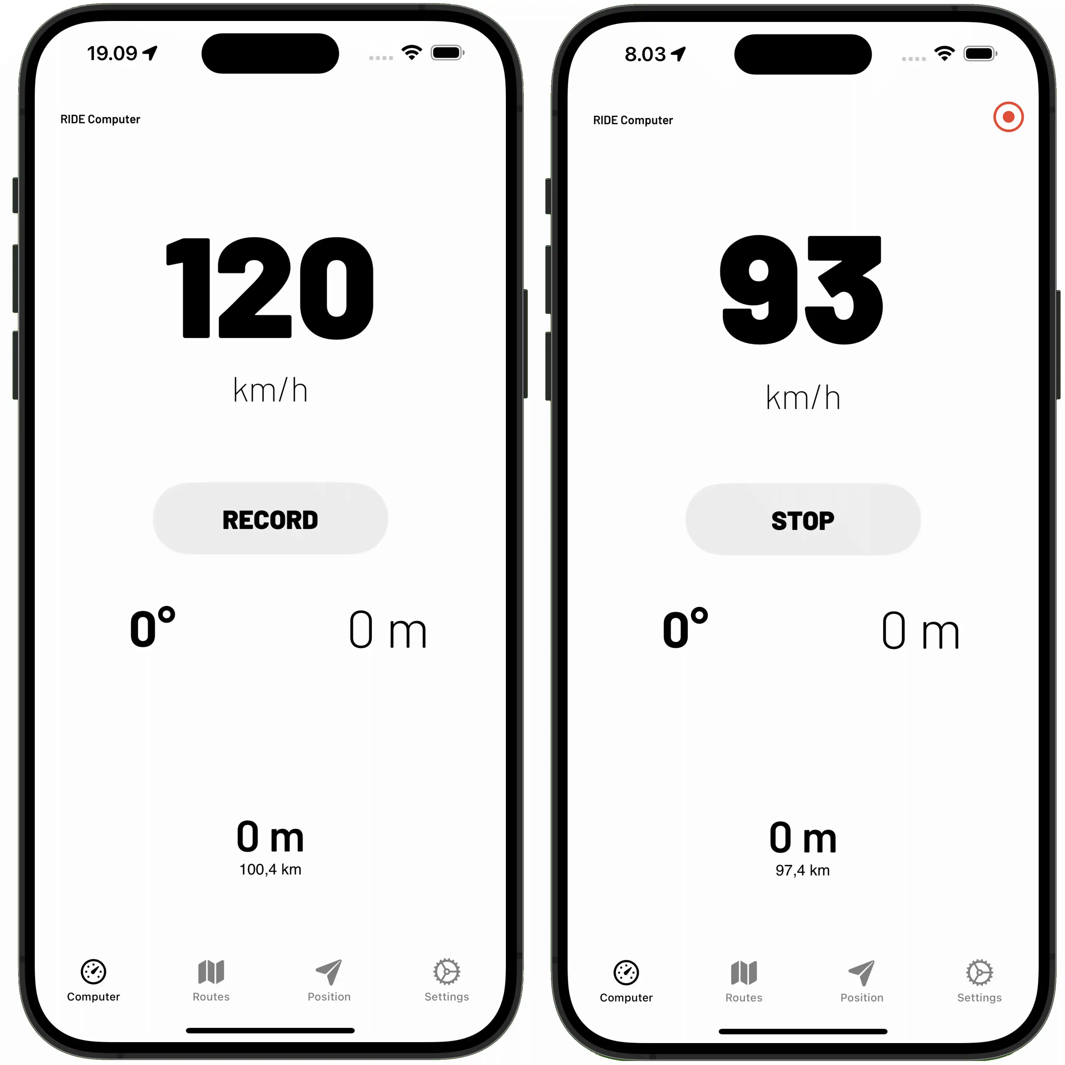
Normally, route tracking is started and stopped manually from the Computer view. The route records the start and end times, waypoints, and speed at each waypoint.
During tracking, you can see the speed, direction, altitude, elevation, and distance traveled in real-time. By tapping on the direction, you can switch it to display the g-force meter or the current time instead. When you stop the tracking, the distance traveled is added to the odometer.
- Recording is in progress.
The recording icon is red to make it as noticeable as possible that recording is active.
- The route is always saved to your phone.
The route data is yours, not the world's. That's why it's stored on your phone, not on the internet.
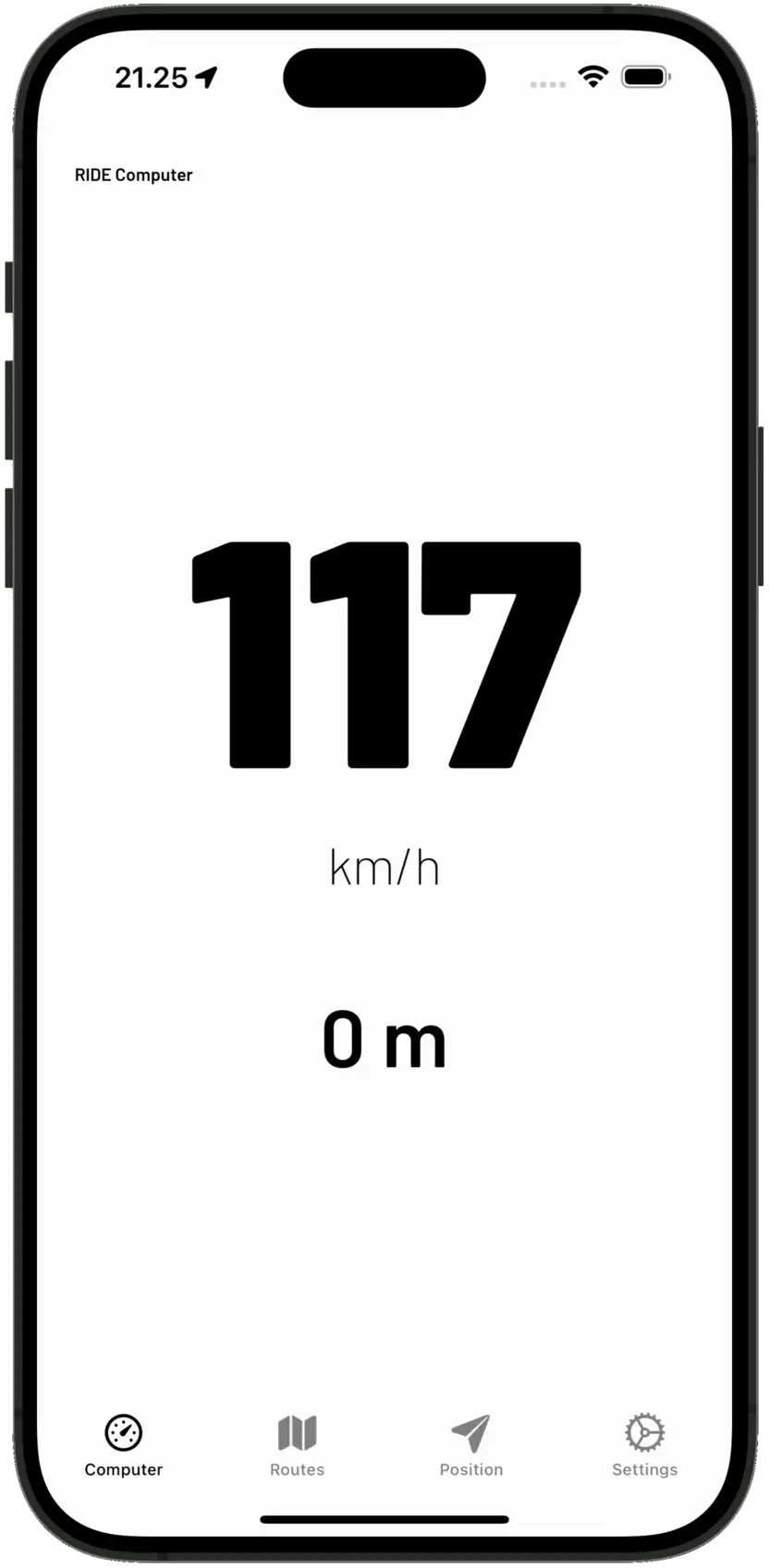
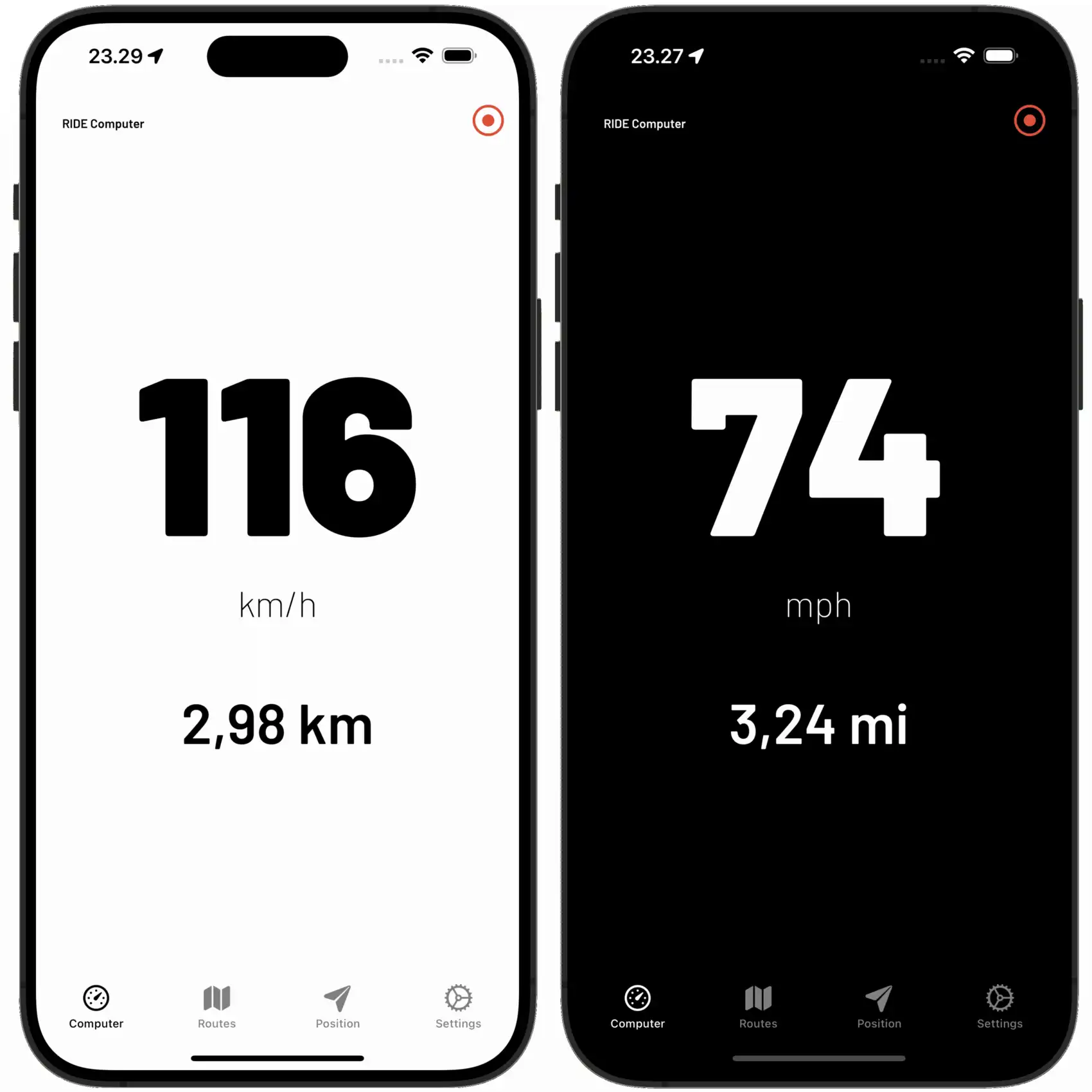
Clear Speedometer
Often there is too much information, so by touching the speed on the main view, a clear speedometer with large font appears.
It displays not only the speed but also the distance traveled and a recording icon, if route recording is active. The font of the speedometer has been carefully chosen to ensure that the speed can be seen at a glance.
From the settings, you can select two color schemes: dark or light. In hot weather, under direct sunlight, we recommend the light scheme, which reduces the risk of your iPhone overheating. The dark scheme is recommended in the evening, as it maximizes the interface contrast.
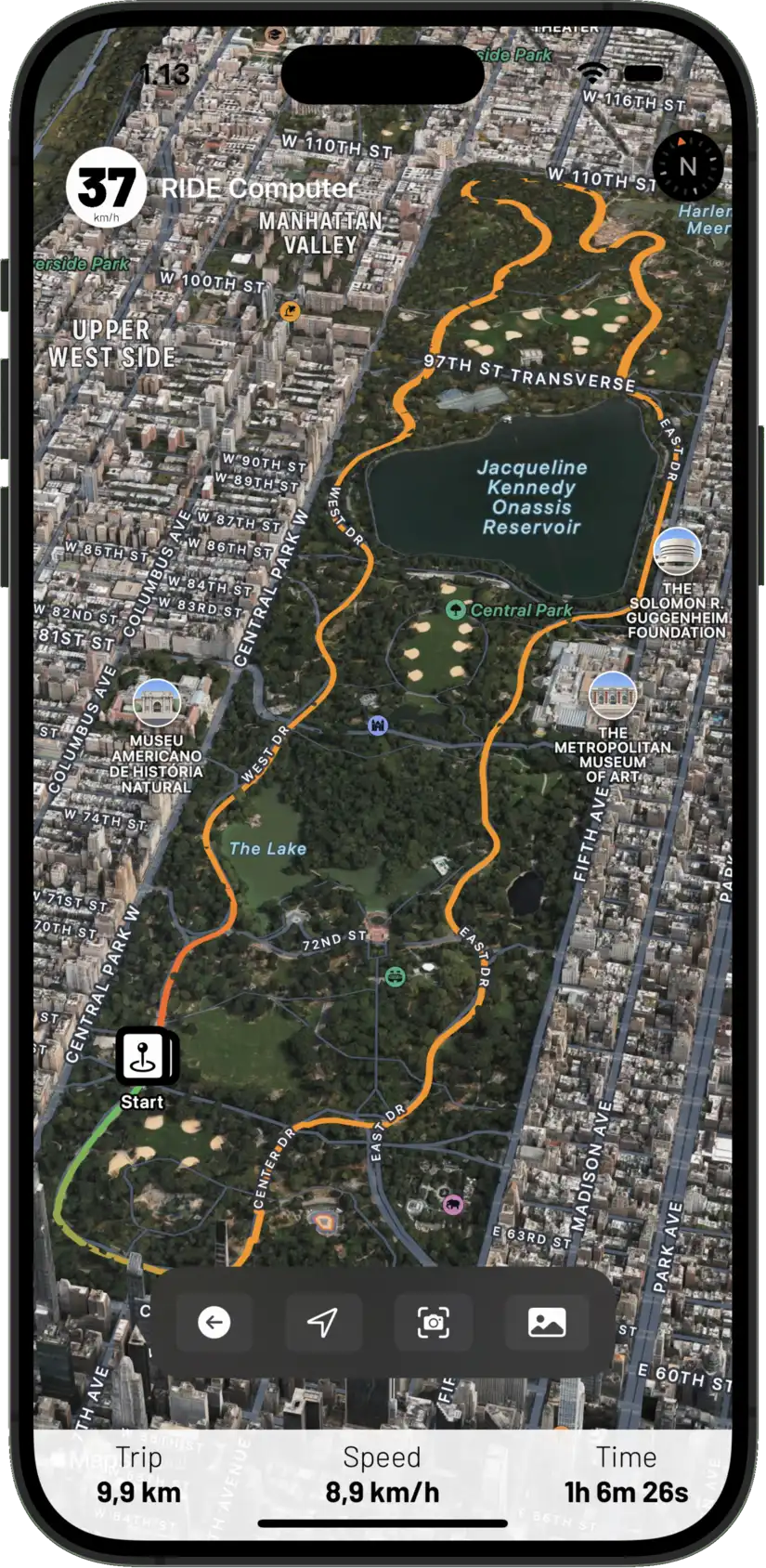
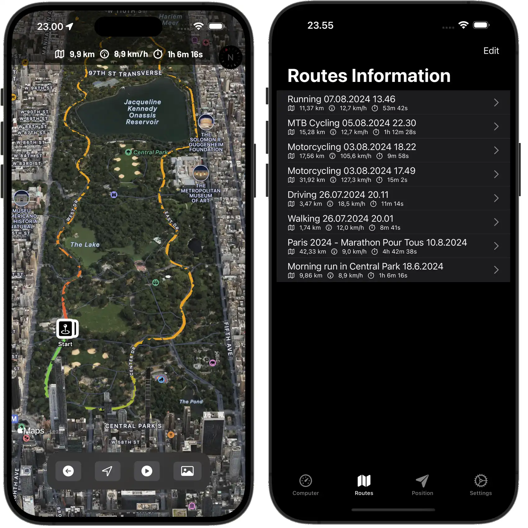
View routes and share them with a friend
All saved driving routes are stored in the route view. You can edit their names, add a description, and select an activity type for each route.
In the map view, you can take a closer look at the route. You can activate the simulator, which will play the route at four times the speed, or take a screenshot of the route, which is saved in the iPhone's Photos app. From there, it's easy to share with friends.
Apple Maps offers stunning 3D views of major cities worldwide, where your route is realistically mapped and beautifully navigates through trees and buildings.
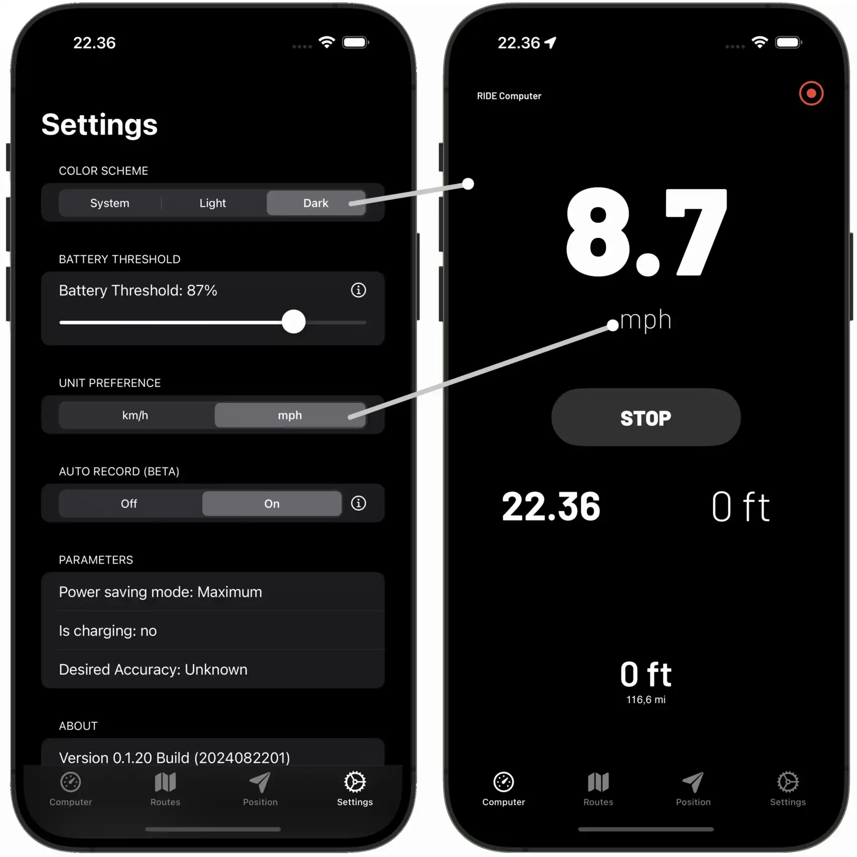
Fine-tune your RIDE Computer settings
In the settings, you can adjust the color scheme, measurement units, automatic saving, and power-saving features.
There are three options available for the color scheme: the system default, light, and dark.
The Battery Threshold feature lets users save battery by setting a limit at which the app will start saving energy. When the battery drops below this limit, the app updates GPS less often, uses less accurate data, and turns off extra features, which helps save battery life. This means the device can last longer without charging, but the app might not be as accurate or quick. Users can set this limit in the app settings, choosing a value between 40 and 100 percent.
If the battery level goes below 25 percent, the app switches to maximum power-saving mode. In this mode, the app further reduces how often it updates GPS, uses even less accurate data, and may stop updating location if the device is not moving. This helps keep the device running as long as possible, but it greatly reduces the app performance and accuracy.
In the unit preferences, you can choose between the metric and imperial systems.
The Auto-Record feature automatically starts recording your routes when start moving. This means you do not have to remember to start recording when you begin moving. However, Auto-Record only works when the app is starts up. Automatic route is currently an experimental feature.